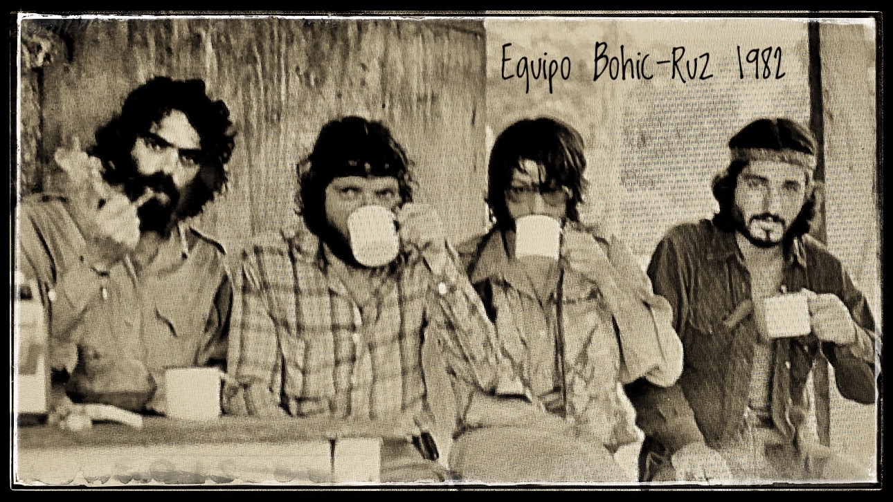
Lacks Heading
-
 KORICANCHA PROJECTExcavations in the Temple of the Sun of the Incas (Cusco, Peru)
 -
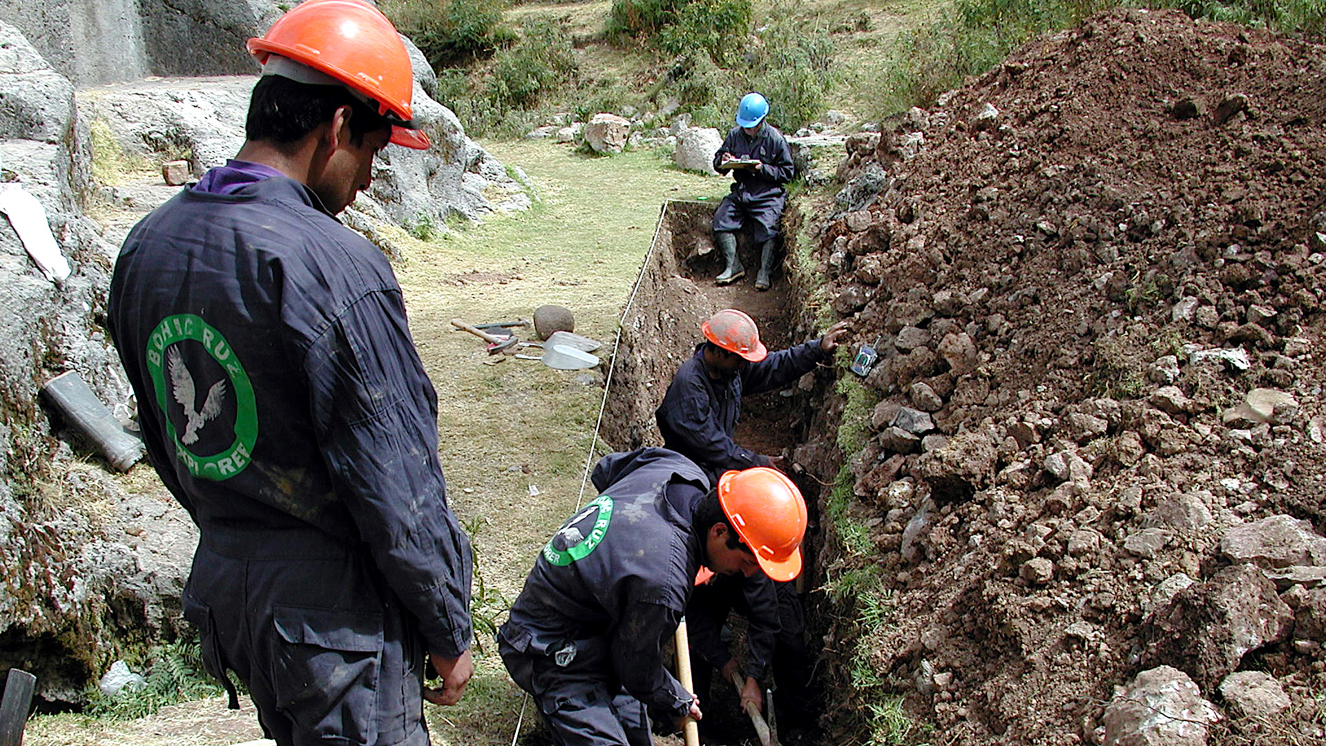 SAQSAYWAMAN PROJECTExcavations in the Chinkana Grande (Cusco, Peru)
 -
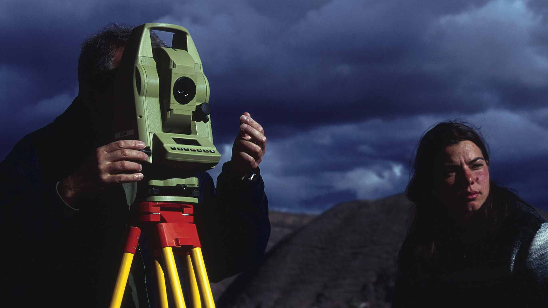 ARCHAEOASTRONOMICAL WORKSArchaeoastronomical works in the Temple of the Sun of the Incas (Cusco, Peru)
 -
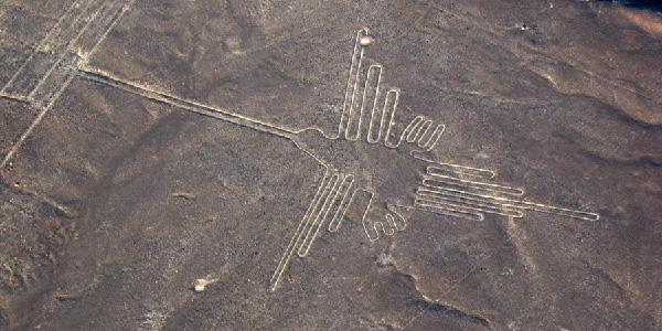
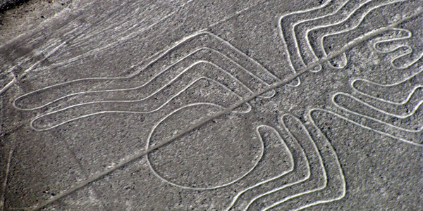
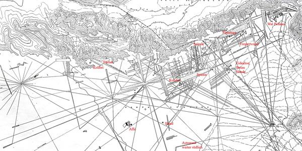
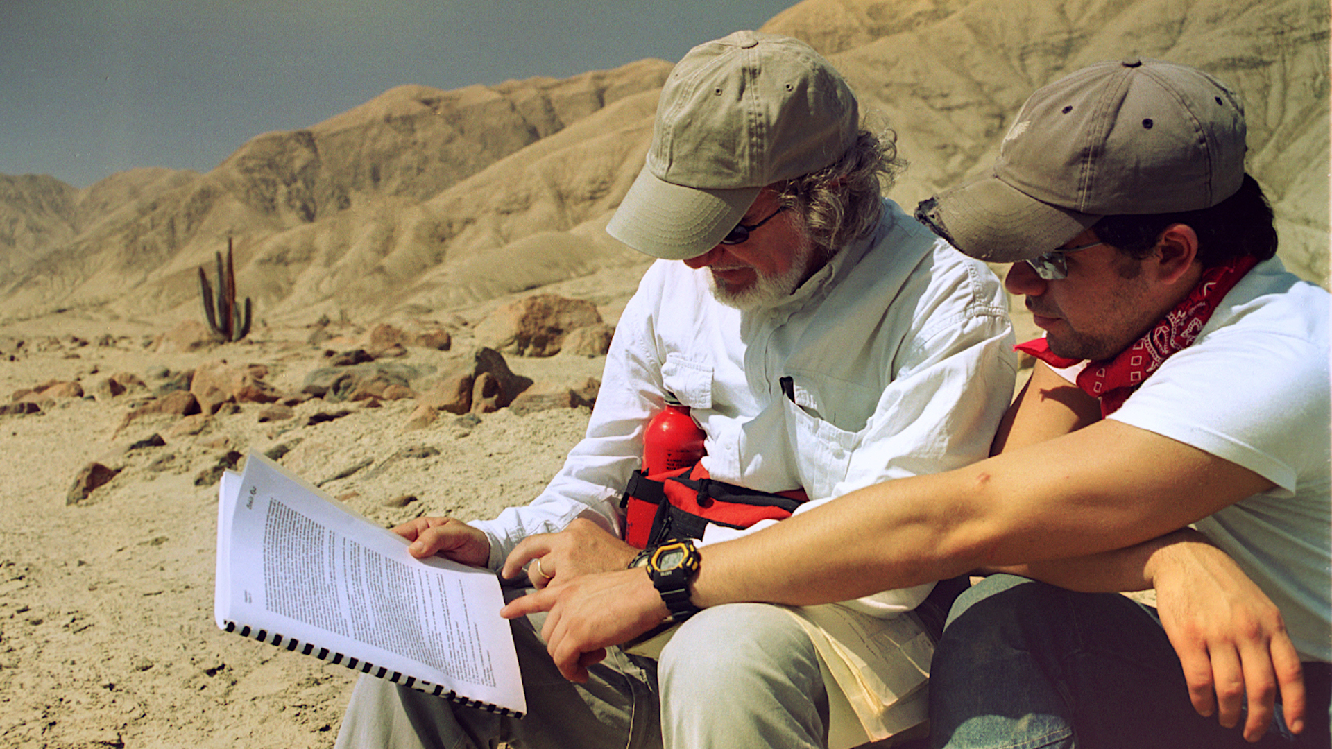 NAZCA DESERTStudy and filming of the Nazca Lines. Archaeoastronomy and interpretation works (Peru)
 -
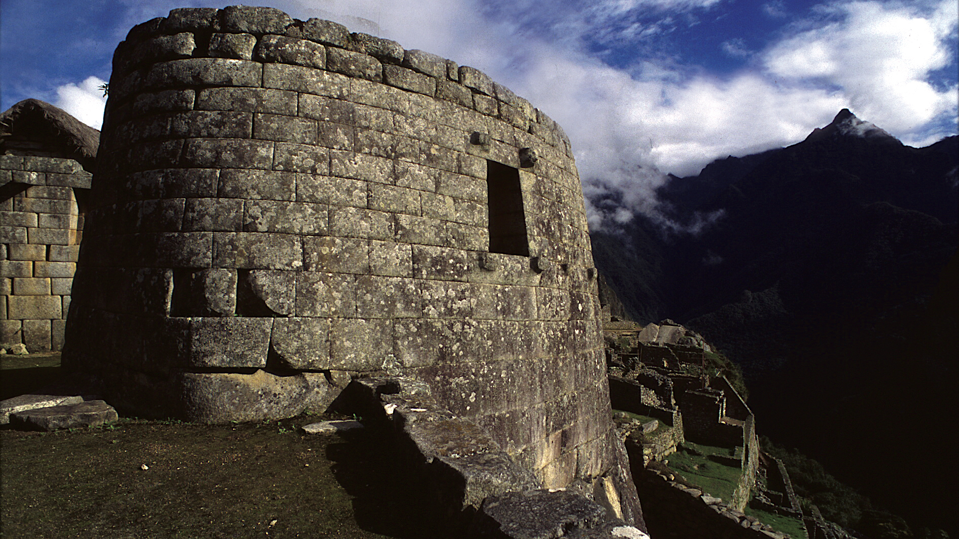 MACHU PICCHUArchaeoastronomy and interpretation work at the Intiwatana
 -
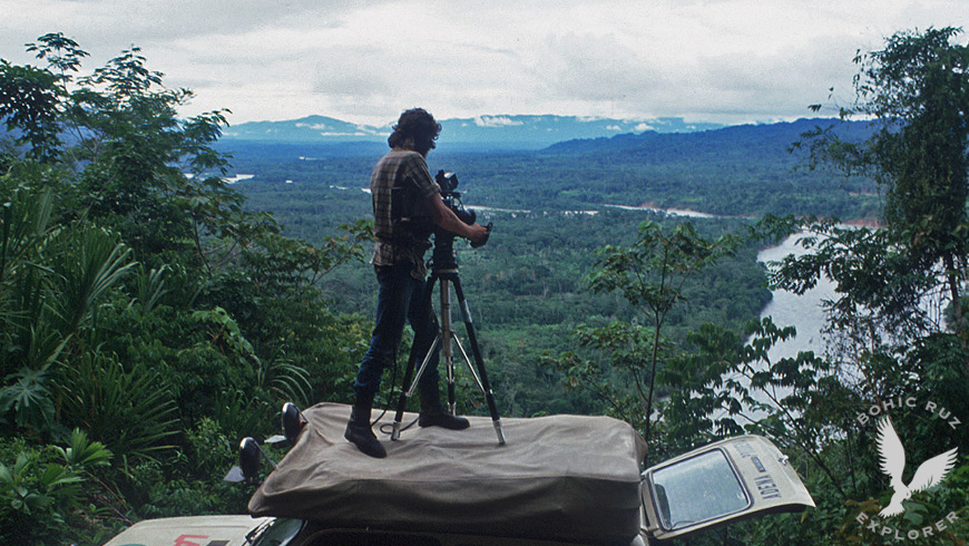
 AMAZON JUNGLEEnvironmental impact studies in the Manu Reserve (Peru) with the collaboration of the North American biologist Dra. Jane Stern, professor of Biology at Berkeley (USA)
 -
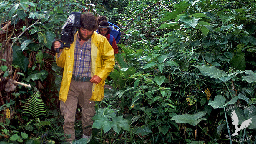
 MASHCOPIROSContact and study with an Amazonian tribe in the wild: THE MASHCOPIROS(Amazon Rainforest, Alto Madre de Dios, Peru)
 -
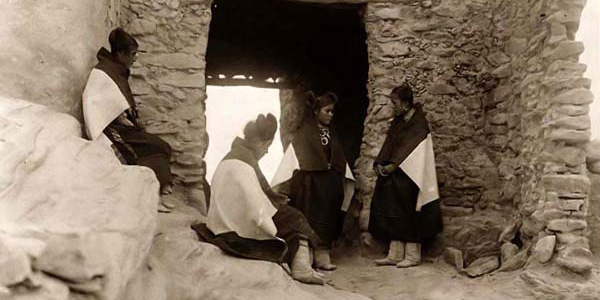
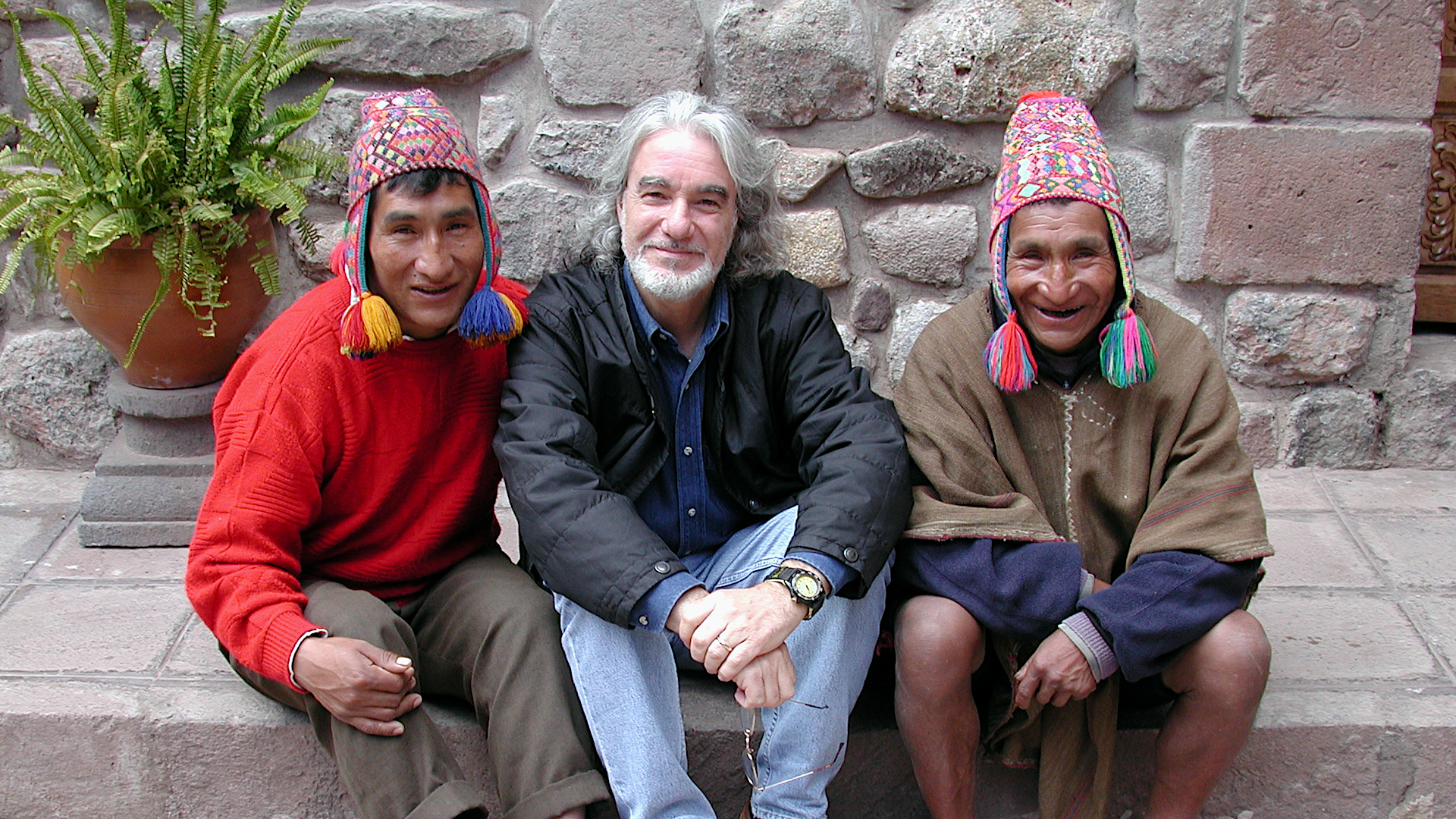 Q'EROS COMMUNITYQ'eros: In Search of the Last Incas
 -
 TIBETAN LAMAISMStudy on Tibetan Lamaism with the spiritual leader, Kalou Kempo Rimpoche, main teacher of the Kagyupa lamaistic line (Sonada Monastery, Darjeeling, India)
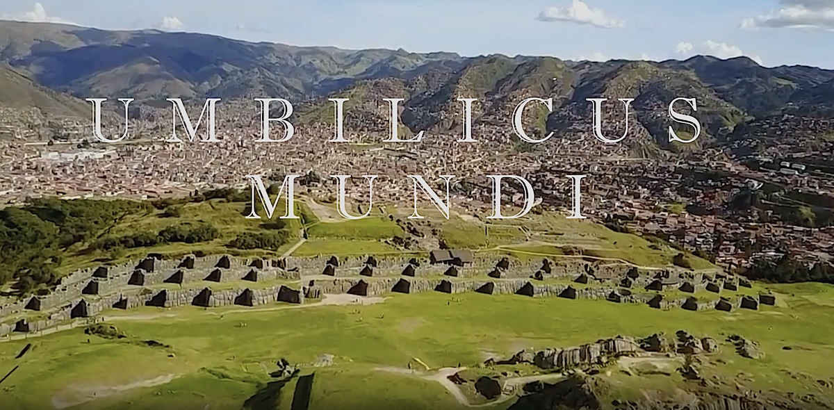
QOSQO PROJECT
THE OPENING OF THE ANDEAN AXIS MUNDI
QOSQO true NAVEL OF THE WORLD, center and axis of a Universal Sacro-Solar worldview
CANDELABRO OF PARACAS
The mysterious GEOGLYPH located in the bay of Paracas in Peru is deciphered
Complete explanation of the meaning of the Paracas Candelabra and its function by Anselm Pi Rambla
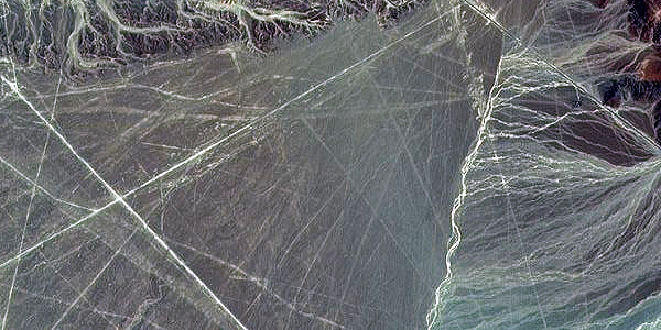
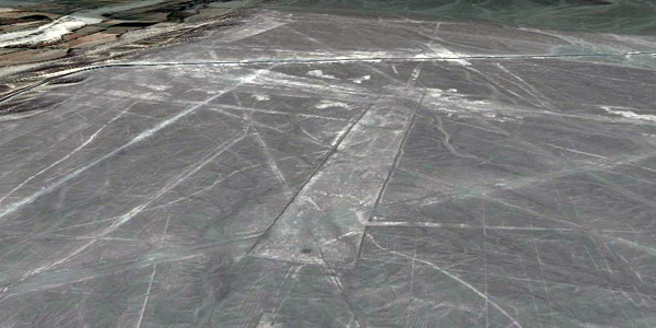
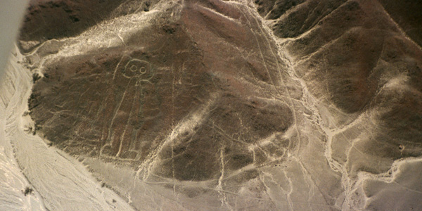
NAZCA PROJECT
THE LABYRINTH OF THE WORLD
Geophysical Research
Archaeological work and analysis in state-of-the-art geophysical remote sensing in the Nazca lines
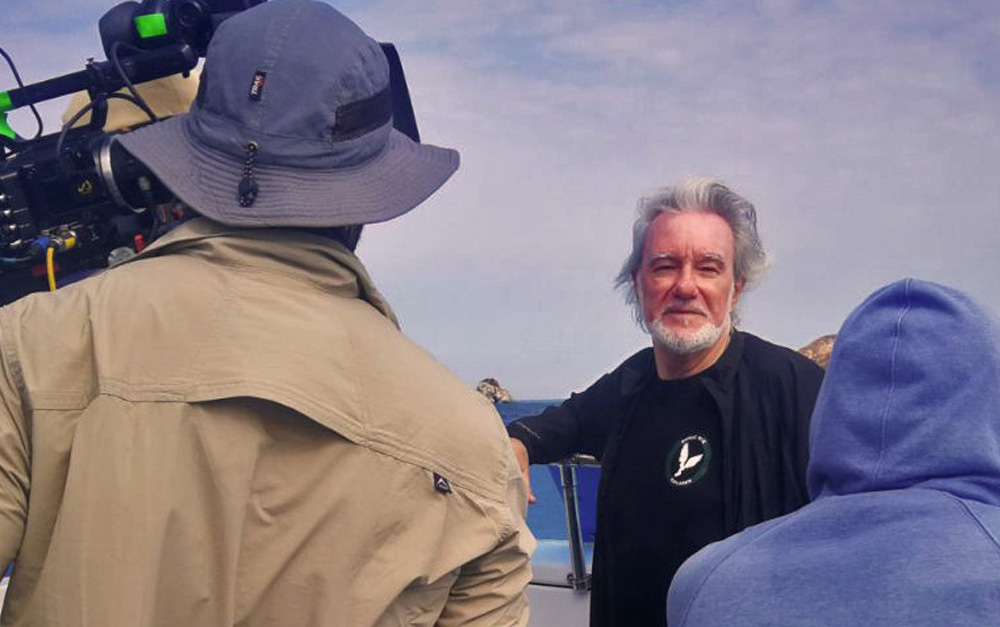
MARITIME EXPLORATION
PERUVIAN PACIFIC OCEAN
Archaeological works on the Peruvian Pacific Ocean coast regarding the investigation of ancient trans-Pacific Asian voyages
Anselm Pi Rambla and his team will carry out underwater surveys in different areas of the Peruvian coast in order to locate archaeological remains of the millenary maritime activity in this important region of the Pacific Ocean. We have significant evidence that suggests that this western coast of South America was an area of significant trans-Pacific landings over 3000 years ago. These investigations are supported by the latest advances in cartography on the ancient works of Ptolemy, Marino de Tiro, Henricus Martellus together with the works of professor Paul Gallez and Dr. Dick Ibarro Grasso.

Historical heritage with non-invasive technologies opens a new chapter in the study of ancient civilizations. The development of this research and the eventual publication of verifiable data will be key to determining the true nature of these discoveries. On this page, we will closely follow each development, sharing both official updates and academic debates surrounding one of the most fascinating mysteries of our time.
PORTFOLIO
OTHER PROJECTS
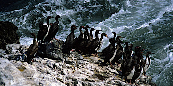
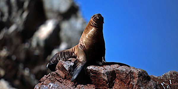
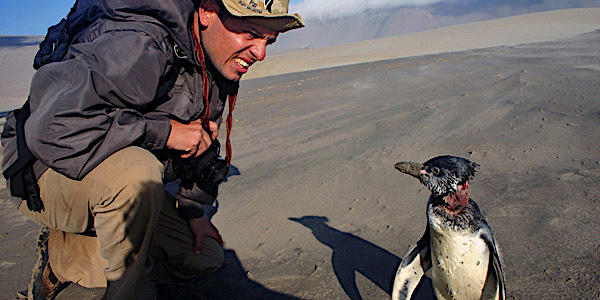
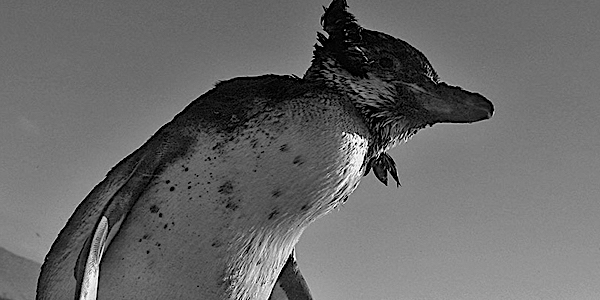
- Migratory Birds (Paracas National Reserve, Peru)
- Ritual Pachamama of the islands Taquile and Amantani (Lake Titicaca, Peru)
- Palenque & Chitzén Itzá, investigation and filming of the ruins (Mexico)
- Pascua Island, Moais study (Chile)
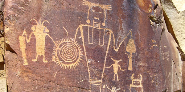
- Atacama Desert, research on petroglyphs and their symbols (Chile)
- Chullpas of Sillustani, investigation and filming of the Chullpas (Titicaca)
- Samaipata, archaeoastronomy studies of the ruins (Bolivia)
- Investigation of the Quero community (Paucartambo, Peru)
- Aguada Blanca National Reserve - photography and filming of the Condor in the Colca Canyon
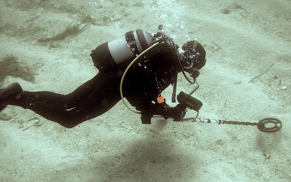
Maritime Exploration
Maritime exploration works on the Peruvian Pacific Ocean coast on the investigation of Asian transpacific voyages in antiquity
Anselm Pi Rambla and his team will carry out underwater surveys in the Pisco-Paracas area in order to locate archaeological remains of the millenary maritime activity in this important area of the Pacific Ocean.
We have important evidences that this western coast of South America was a maritime zone of important transpacific landings more than 3000 years old.
These investigations are supported by the latest advances in cartography on the ancient works of Ptolemy, Marino de Tiro, Henricus Martellus together with the works of professor Paul Gallez and Dr. Dick Ibarro Grasso.
Mountain Gorillas
Research work, carried out by Angela de Dalmau, on the mountain gorilla at the Karisoke Research Center, directed by Dian Fossey


Dian Fossey

Dian Fossey (January 16, 1932 – December 26, 1985) was an American zoologist. She is best known for studying gorillas in Rwanda. Fossey was inspired by a book called The Mountain Gorilla by George Schaller. Fossey studied mountain gorillas in Rwanda because of the book. When people want to get close to gorillas and get to know them they have to gain the gorillas trust. Fossey changed her lifestyle to match the gorillas’. She wanted to protect the gorillas from hunters. Hunters were trespassing on a non-hunting ground. She also wanted to protect the endangered animals in the area, even though some people didn’t agree with her ideas. She is a hero to many people for what she did to help mountain gorillas. There is a movie that was made based on what she experienced in Africa. The movie is called Gorillas in the Mist. Her book, also named Gorillas in the Mist, is the best-selling book on gorillas of all time. She is recognized for saving mountain gorillas and starting a successful fund to help raise money for gorillas everywhere.
Geophysical Research
Archaeological and geophysical works on the Nazca lines
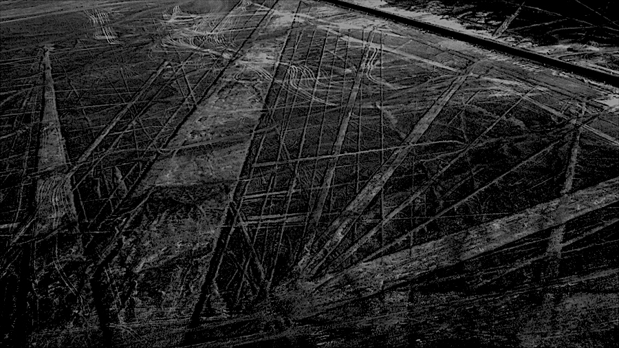
When flying over Nazca, it is enough to observe the immensity of this desert to where these lines are observable to realize that their whole is chaotic; Some end up abruptly, others intersect in any direction, some are lost in front of the coast towards the Pacific Ocean, there are others that are directed towards the Andean mountain range, being impossible to determine that its design and utility are only astronomical. All of this without forgetting that many of the lines appear on other older, barely visible, that point to different directions. We have done many reconnaissance flights in an area from Paracas to beyond Nazca and we have observed many lines that still today have not been discovered or analyzed by official science. The scarce rains of this area, one of the driest on the planet, and the lack of obstacles to the wind, which releases its sand about a hundred kilometers to the north, make the drawings are maintained almost indefinitely. Observing this true chaos one realizes that the different interpretations that have been made on Nazca are far from the reality of what they are and for which they were constructed. We are convinced and this is where our work points out that it is necessary and essential to combine many more research disciplines such as studies of history, ancient symbology, geological studies, archaeastronomic and the latest advances in underground remote sensing systems among others.
Nazca Plate - Atacama Trench Archaeological remains
One of the investigations that we think is most important to consider is why the Nazca Lines are located opposite the critical point of suction in the Atacama Trench due to the push of the Nazca Plate in the Pacific against the South American Plate causing the Andes to rise increasingly.
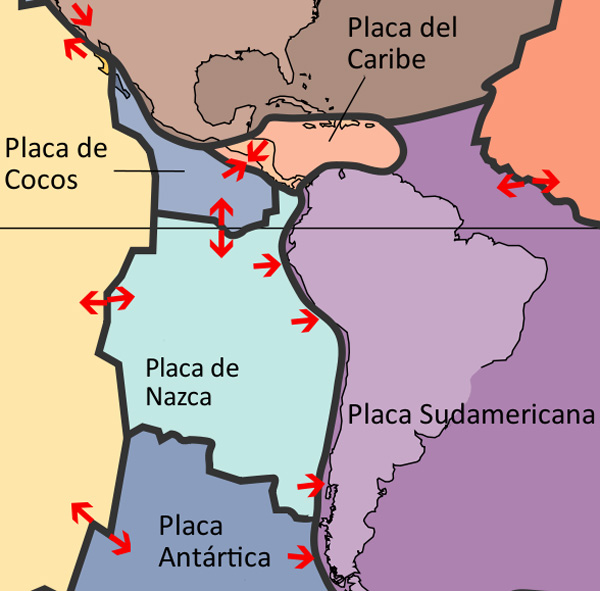
When the earth's crust collapses at one of its inflection points, ancient archaeological remains of the area have been thrown into the ocean abyss. As a notable example of this we can cite the photographs of the "Milne-Edwards" pit taken by Dr. Menzies, of Duke University, from the oceanographic vessel Anton Bruun in 1965, off the coast of Peru.
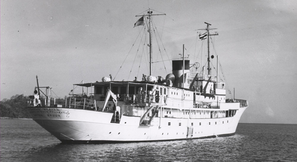
The sonar recordings made in this area indicated very strange configurations in the ocean floor, which was apparently a muddy surface. The photographs taken at a depth of 2000 meters showed what looked like huge pillars and walls, some covered with calligraphic signs.
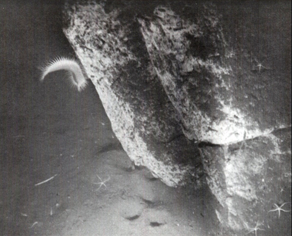
When they tried to take other photographs they noticed that although the position of the special chamber was modified by the submarine currents, other plates of rocks with artificial forms were obtained that lay on the sides, and some of them in piles, as if they had rolled one on top other. This happened at a time when many archaeological remains sank to a depth of more than 1500 meters at the bottom of the sea. Although this incident shows one of the deepest depths of the ocean in which ruins have been found, it is probable that future underwater explorations, carried out at the same or similar depths, will provide definite evidence, in the relatively near future, of the existence of civilizations Whose remains lie now at the depth of the world's oceans.
Can the Nazca Lines be related to these underwater remains?
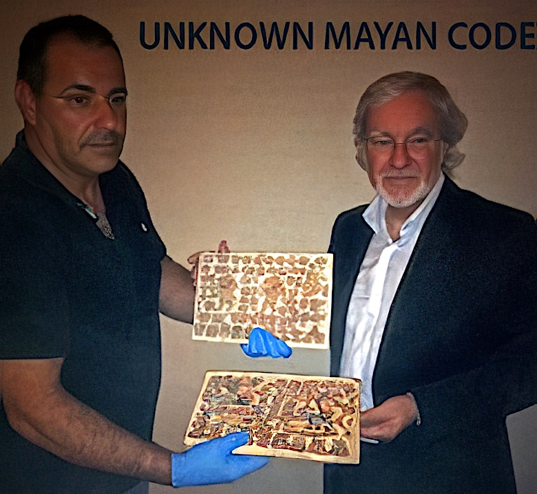
Unknown Maya Codex
Previously Unknown Mayan Codex Discovered and Authenticated by Period Experts
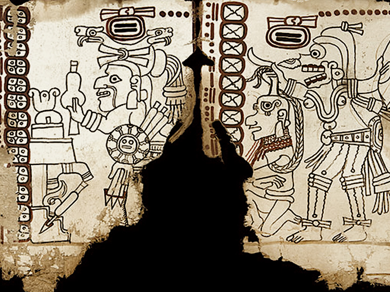
A few days before the famous end of the Mayan cycle of 5125 years ending on 12/21/12, a new Maya Codex unknown to date has been presented to the international community. A research team has discovered an invaluable piece missing from the Mayan culture. The lost codex has been safeguarded by a family for almost three centuries. According to experts, this Codex is one of the best preserved of the 4 existing in the world with an antiquity of (+/-) 1540 AD. It is protected by carved wooden front and rear covers. In a first analysis they have intervened: Roderick McNeil, Anselm Pi Rambla, McCrone Associates and Janet G. Smith, ISA.
MAYA CODEX REPORT
IMPORTANCE OF THE NEW MAYAN DISCLOSED CODEX
by Anselm Pi Rambla
The Maya are bearers of one of the most complex and ancient scriptures of Mesoamerica, from very early times produced an enormous amount of hieroglyphic texts, which they showed a wide variety of topics. The texts that have survived from those times are in stone monuments, ceramics and murals, as well as in their famous "Codex", of which there are three known as authentic: the Dresden, Paris and Madrid, named after the city where they are currently located. These three Codex (books of paper, folded and painted on amate bark), developed in the Late Post classic have been of invaluable importance for the understanding of the Mayan worldview, their system of counting time and calendrical structure, their religion and their associated gods and rituals, and also of course to the decryption of their writing, among many other aspects. We must note that the writing of these Codex have several symbols to represent the same idea, and its reading is rich in expressions, but highly codified and complex, making it difficult to decode them. I want to mention that because of this complexity, it has paid little attention to the "mythical" components in the Codex. An example of this are the numerous references to the date 4 ahaw, 8 Kumk'u, corresponding to August 3114 BC, it’s a purely calendric date used to calculate the corresponding historical time to the scribes, but that at the same time is a mythological date which begins the cycle of the Long Count calendar. This new Codex that has remained unknown to date opens the possibility of understanding much more these mythical components still un-deciphered, totally necessary components to penetrate the true knowledge of the Mayan culture. We have a historic invaluable opportunity in deciphering this unknown "Codex" which undoubtedly will provide a broader view of this important civilization.
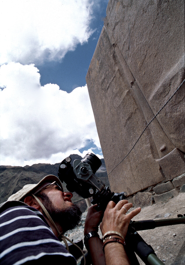
Ollantaytambo
Research and filming works
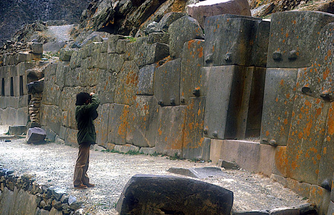
We make films and archaeological and archaeoastronomical research in the ruins of Ollantaytambo, one of the most monumental architectural complexes of the Andes, 80 km. From Cusco in the Urubamba Valley. Commonly called "Fortress" because of its huge walls, it was actually a city-bed and a solar temple, strategically located in the famous "Sacred Valley".
The architectural type used, and the quality of each stone, worked individually make Ollantaytambo one of the works of spectacular and remarkable engineering that made the ancient Peruvians, especially in the area of the Temple of the Sun with its gigantic monoliths.
TEMPLE OF THE SUN
According to Pi Rambla, the sector of the Temple of the sun of Ollantaytambo, which is only a wall was not built by the Incas as announces the official archeology (DC 1440) but by an ancient culture that is still unknown. According to their research, some of the granite stones that make up this wall weighing over forty tons were transported from the mountain which is across the river of a distance of 4 kilometers with a height of over 800 meters.
Many questions arise that even conventional science could not explain: How were they transported these enormous blocks of stone from a quarry located 4 kilometers away, perched on mountain slope to the very top where the sun temple is located? How they were planted and put in place?.
By whom they were built these ruins? It really was the Incas their true builders?
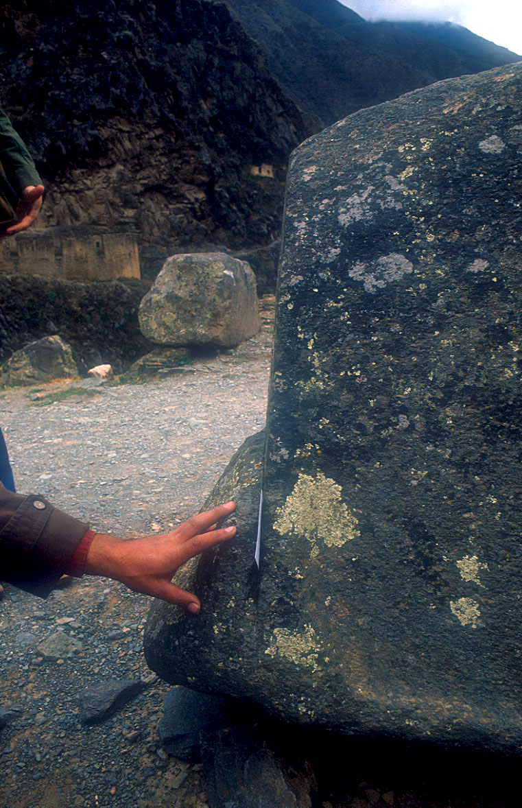
Spectacular rock cut made with a totally unknown and very sophisticated technique as we can see in the photo. How they were cut and polished with such a level of perfection?. This is not achieved with tools of stone or bronze, as these materials do not make a dent in andesite and pink granite that Ollantaytambo was built. How did you managed to gather each other with such improbable perfection, you can not insert a sheet of paper in the joints? and they did it without any mortar or cement or some kind of sealant.

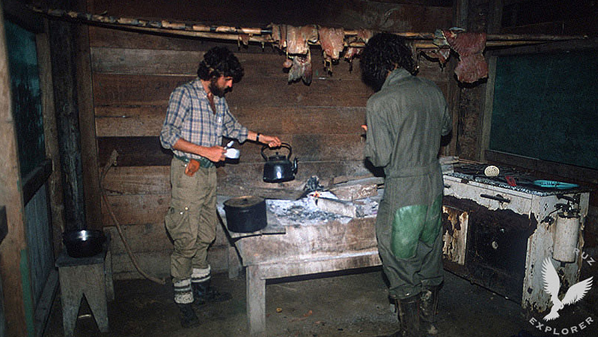
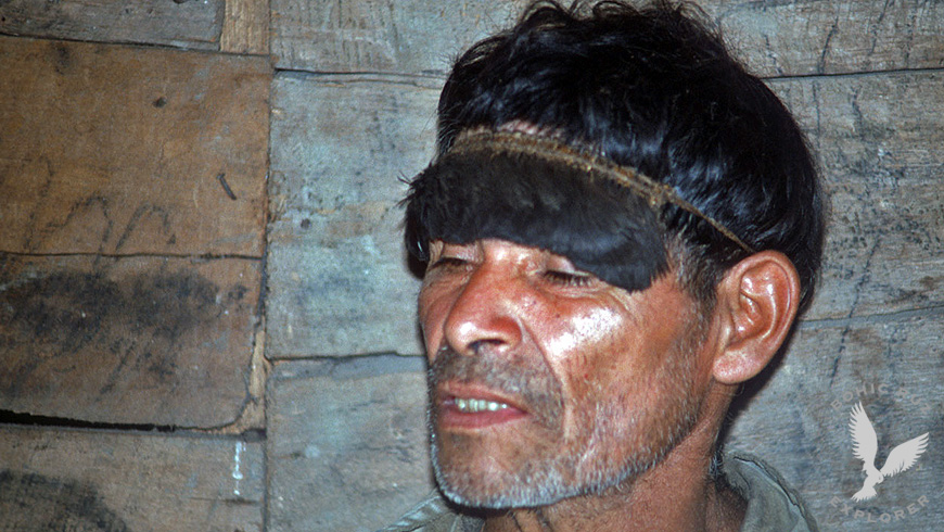
Amazon Jungle Expedition
Mashcopiros uncontacted tribe
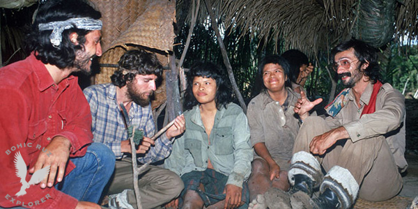
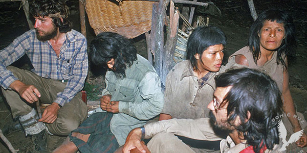
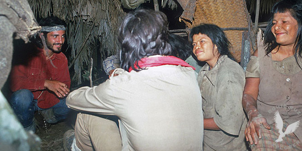
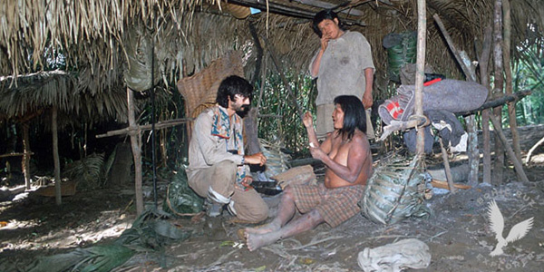
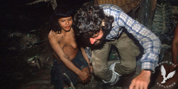
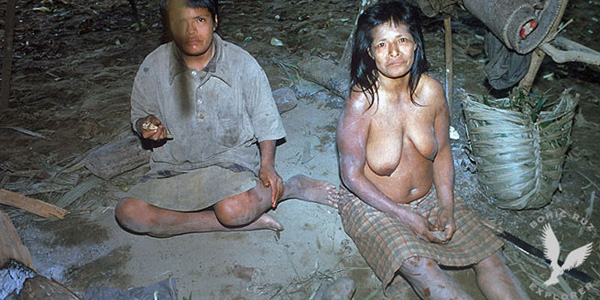
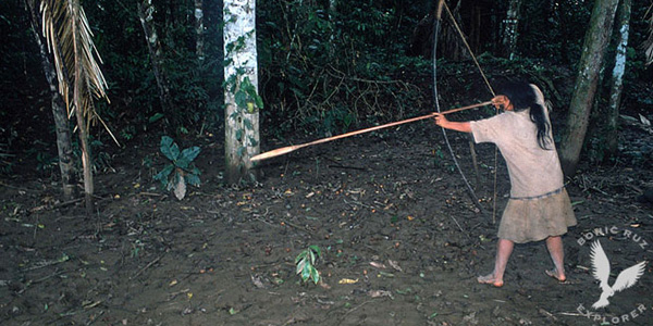
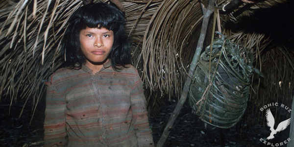

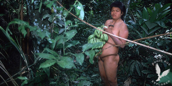
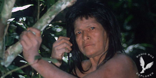
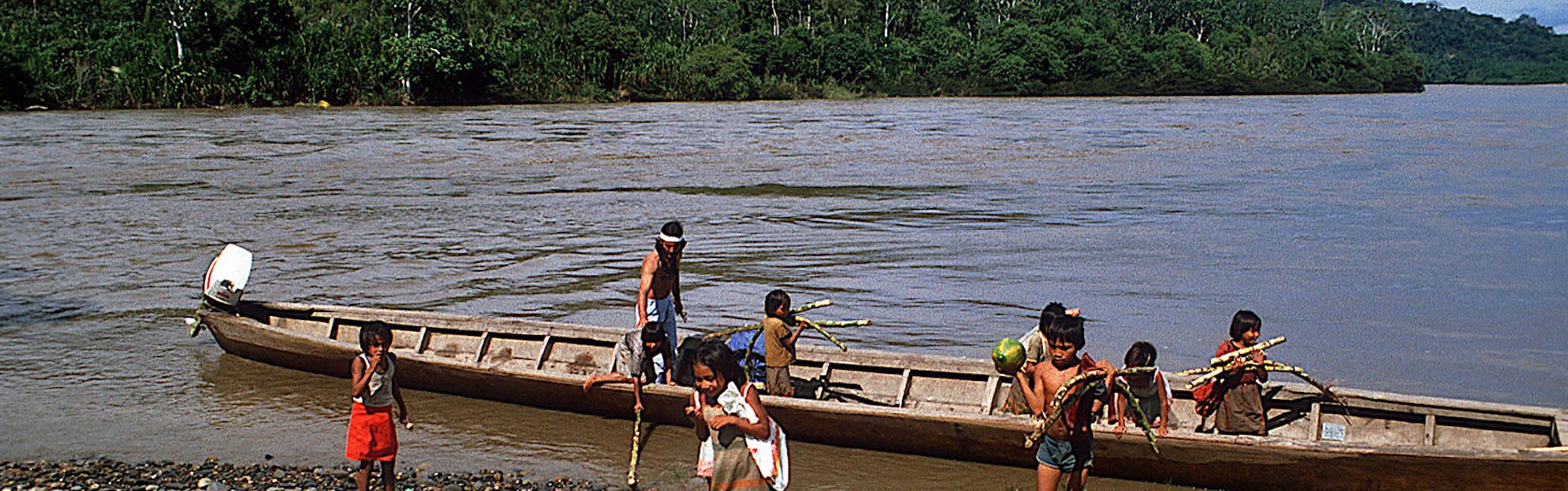
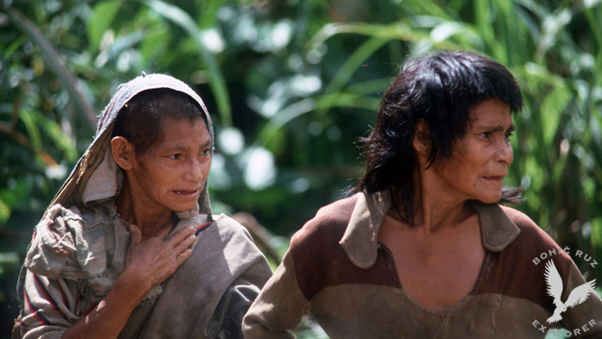
The Pi Rambla Team made a high-risk expedition to Alto Madre de Dios (Peruvian Amazon Forest) in search of evidence of the existence of the mythical citadel of PAITITI (The Golden City of the Incas). This territory of the Amazon rainforest, one of the most inhospitable and unknown of the planet, is according to many reports the place where the famous citadel is so sought after by many explorers and adventurers. An area that the same guides do not want to penetrate for fear of reprisals of tribes very bellicose and not yet contacted. In a very dangerous area of the jungle we were lucky to contact for the first time with 3 women of the unknown Mashcopiro tribe. A tribe that has never contacted our civilization to date and that no expedition has ever been so close to them. With our native guides Piros and Machiguengas who accompanied us we tried to establish a communication with the 3 women with great difficulty because they spoke a different and unknown dialect. The data that we could obtain indicate that, in its territory, there are archaeological ruins of the Inca area that could be the remains of the famous Paititi mentioned in many ancient traditions. The place is very difficult to access because it is guarded by native tribes that do not let any stranger penetrate.
Mashcopiros uncontacted tribe
The three Mashcopiro women spoke a dialect totally unknown and were displaced about 10 kilometers from their camp, apparently expelled and marginalized by their own tribe. Our native guides did not dare to go further from that place, since we had been attacked by very bellicose Indians. It is believed that in this area there are approximately 5000 Indians of different ethnicities not yet contacted: "Yaminahuas, Amahuacas and Mashcopiros among others".
first contact with the Mashcopirian tribe (NEVER contacted by our civilization)
The Hopi Way
Study the Hopi traditions with Dan Evehema Family
Pi Rambla Team participated in an ethnological research with leaders and relatives of the spiritual Hopi leader Dan Evehema in Hoteville, Arizona
The Hopi Tradition
According to his tradition, the history of mankind is divided into periods they call "worlds", which are separated by terrible natural disasters: the first world succumbed by the fire, the second by the ice and the third by Water. We currently live in the fourth world, and in total, mankind must go seven. Not being verifiable historically the first two worlds, the Hopi tribal memory goes back to the time of the Third World, whose name was Kasskara. This was the name, in fact, of a vast continent located at the current site of the Pacific Ocean. But Kasskara was not the only inhabited earth. There was also the "country of the East". And the inhabitants of this country have the same origin as those of Kasskara.
The Katchinas arrived by Air
The people of that country began to expand itself and conquer new lands, attacking Kasskara face of opposition from the latter to be dominated. They did it with very powerful weapons (and one immediately thinks of the devastating weapons described in ancient Hindu epics and the atomic explosion of Sodom and Gomorrah), impossible to describe. Only the elect, those selected to be saved and survive in the next world were gathered under the "shield". The enemy shells burst in the air, so that elected placed under the "shield" remained unscathed. Suddenly, the "country of the East" for some unknown reason disappeared under the waters of the ocean, and gradually began to sink Kasskara. At this time, the katchinas helped the elect to move to new land. This marked the end of the third world and the beginning of the fourth. We must clarify that, from the first world, humans were in contact with the katchinas, word that can be translated as "venerable sages." It was visible beings, of human appearance, they were never taken by gods but only as beings of knowledge and potential higher than the human being. They were able to move through the air at enormous speeds, and land anywhere. Since it was corporeal beings, They needed to travel to this displacements a flying machines, a "flying shields" -as in the Roman chronicles, like in the chronicles of Charlemagne who received different names. Today katchinas no longer exist on Earth. The katchinas dances, as well known in America today are represented by men and women as a substitute for existing beings on the old times. The katchinas could sometimes look strange, whereas they originally katchina used to make dolls for children to get used to his appearance. Today, these dolls are preferably made for tourists and collectors.
The Great Exodus
The population, according to the traditional memory of the Hopi came to the new land in three different ways. Selected to tour, inspect and prepare, they were brought there by air, on board katchinas shields. The great rest of the population had to save the enormous distance aboard boats. And it was made this journey along a string of islands in the northeast, extending to the lands of South America today.
The Touched by Lightning
The new land called Tautoma, which would mean "the touched by lightning." Tautoma was also the name of the first city erected on the banks of a large lake. According to current knowledge, Tautoma it identifies with Tiahuanaco while corresponds to the Titicaca Lake, in the current border between Peru and Bolivia. Subsequently, a cataclysm rocked the city, destroying it, that is the reason the population was scattering across the continent. For a long time these men from the Pacific were dealing in groups and clans on both sub-continents. Some of these clans were in the company of katchinas, who often intervened to help. The Hopi were part of the group of tribes who migrated northward, and legends recall a period when they crossed a warm jungle, and a period in which they encountered an "ice wall" that prevented them from advancing towards the north, and forced them to turn back.
The Red City
Long after these migrations there were clans that still retained the ancient doctrines. These clans came together and built a city "of a trascendental importance, which was called the red city "", which is identified with Palenque in Mexico's Yucatan. In this city it was established school of learning, whose influence can still be detected in some Hopi. The teachers of the school were the katchinas, and teaching material consisted essentially of four sections: 1. History of the clans 2. The nature, plants and animals 3. Humans, their structure and their physical and mental functions 4. The cosmos and its relationship with the maker After a period of numerous clashes between the cities established in the Yucatan, the inhabitants left the area and resumed their northward migration. During this turbulent time the katchinas left Earth. The few clans that have continued to keep alive the ancient knowledge gathered later in Oreibi, being this the reason for the special significance of this place.
Tunnels and underground facilities
After collecting all the information in these traditions on katchinas, we can say the following conclusions about these beings who, without being considered as divinities at any time and this is important, they are at the cosmic level of a direct interference in the Works with humans: they had physical body, had the appearance of men in many aspects behave like men, but they had very superior knowledge than humans. They possessed flying machines, and a mysterious shield rejecting the enemies projectiles at high altitude. They were also able to make children for women without any sexual contact. To this must be added the skills that humans learned of katchinas, the most important of which was perhaps cutting and transport of huge stone blocks and, and related to that, the construction of tunnels and underground facilities.
The messengers of the gods
Some of these traditions and findings can corroborate observing the customs of its immediate neighbors, the Zuni and Pueblo Indians, who along with the Hopi are the group of people in the current Arizona. For example, the Zuni, whose temples are underground ceremonial chambers, preserved the cult of the plumed serpent as celestial deity, indicating the Mexican origin of certain elements of their religion to link directly to the image and cult of Quetzalcoatl (identified with Kukulcan and Gucumatz) that it was also feathered and flying serpent, somewhat corroborating the narrations of the Hopi who claim to have established for some time in the area of Yucatan. Zuni They also worship the Katchinas for them messengers and intermediaries between the gods of heaven and humans. Thereby practically identified with -messengers of divinity, that in biblical texts operate under the concept of angels. Another curious fact is that this group of Indians practice the art of painting in dry sand or pollen, in front of their altars for religious ceremonies. The origin of this art is unknown, and it is also practiced in Tibet and among some tribes of Australia.
In their reserve of Arizona, the Hopi Indians still maintain the custom of elaborate masks and puppets called katchina or kachina and strictly follow the way of processing and the same "designs" for many centuries.
Hopi message
The modern man sees the old wisdom and ancient knowledge like a dead and useless thing and not respected, only depends on the money system with its extreme consumerism. When food becomes scarce and ecological soil conditions are unbearable, the man attempt to correct the error that caused the earth because of their inventions. You will have to find some method to heal the wound, but this will not be possible when we have reached the point of no return.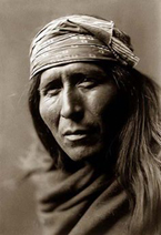
Only peace with the earth and the human being can survive only if the human race we are ready to change this possible. The Hopi play an important role in the survival of human beings in their vital communication with the unseen forces of nature to maintain balance, as an example of practical alternative to suicide system created by modern man. The message is simple if a change towards peace does not occur: "The whole world will shake and turn red and will go against those who interfere Mother Earth".
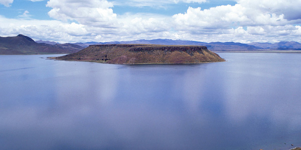
Works in Tiahuanaco & Titicaca Lake
Archaeoastronomy studies and filming of the ruins
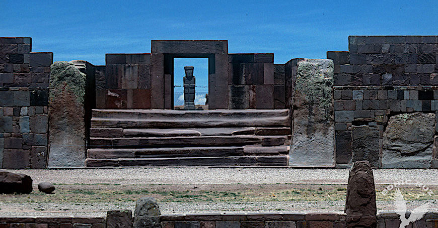
Archaeoastronomy Works
When the conquest of Peru by Pizarro, the Incas claimed that Tiahuanaco had never known anything but ruins. Their elders and sages claimed it was the city of the first men of the Earth, which was created by the god Wiracocha. Arthur Posnansky, begginings of the XX century, was the first to propose a dating of Tiahuanaco based on the alignments of the monoliths at certain star positions. He found that the angle at which the horizon of Tiwanaku was in the time of its construction (obliquity of the ecliptic, not to be confused by with the phenomenon of precession) was 23º 8'48'' and corresponded to an undetermined date around 15,000 BC During the years 1927-1930, scientists from other disciplines checked carefully Posnansky investigations. These scientists, members of a powerful group who also studied many other archaeological sites in the Andes, were Dr. Hans Ludendorff, then director of the Astronomical Observatory of Potsdam, Dr. Friedrich Becker of the Specula Vaticanita, and two other astronomers: the Professor Arnold Kohlschütter, University of Bonn and Dr. Rolf Muller of the Astrophysical Potsdam Institute. After three years of meticulous work, the scientists concluded that Posnansky was basically right, and the proposed date of 15,000 BC It was within the limits of the possible. Posnansky developed a theory that an advanced civilization populated America much earlier than most experts assumed that civilization and died after a devastating cataclysm. And inevitably emerged a name to explain the cultural origin of Tiahuanaco: Atlantis.
That was his mistake. The conclusions of Posnansky were cornered because of the scientific academy on that damned continent.
According to some Andean traditions tell us that the original name of Tiwanaku was "CHUCHARA" and that there were two cities one below the other, the main underground. In the living area workers and workshops they were. The underground city would give us the key to a remarkable civilization, dating back to the early days. It was acceded to it by several entrances that ended at the site of Tiwanaku. Without ruling out or belittle these ancient traditions and adding the data collected during many years of research by our team, we think that at a depth between 10 and 25 meters, there is another Tiahuanaco. We agree with the investigations and conclusions of Oswaldo Rivera (INAR former director of the Institute of Archaeology of Bolivia). We think it might be a huge sunken city, which must accommodate the unique culture of the place. We currently don’t have sufficient evidence because it has been excavated only 5% of its surface. To date there are five periods for Tiahuanaco detected, and there is an obvious relationship to each other. But still we do not know if will be a pre-tiahuanaco culture.
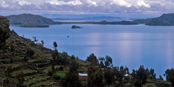
Ruins in the Titicaca Lake
The search of archaeological treasures is what has motivated most of the expeditions to Lake Titicaca. In this case, the figure of William Mardoff American diver, hired in 1956 by a Bolivian millionaire to rescue a supposed hidden treasure to be found among silt and abundant aquatic vegetation. After a long search, did not find any treasure but Mardoff described details of "a city submerged of Titans that is partially covered by mud and algae." In 1968, Argentinean Ramón Avellaneda led the expedition called Fer de Lance. The large number of photographs and films were achieved and the strongest evidence of the existence of submerged cities in the sacred lake. Divers who made up this underwater mission found huge monolithic stones assembled together, forming walls, similar to those of Sacsayhuaman. They also found perfectly paved roads with huge stone slabs that were lost in the mud and algae. Analyzed the p hotos, they reached the conclusion that it was megalithic ruins. In 1979, while the film The Sacred Lake, is filmed under the direction of researcher Hugo Boero Rojo, the team found "similar to the fortress of Sacsayhuaman Cyclopean embankments". La Paz newspapers published on December 4, 1980 statements divers: "monumental stone blocks that appear to be half-destroyed walls of temples, paths that are lost in the deep caverns, roads that go deep into the depths were found from the lake".
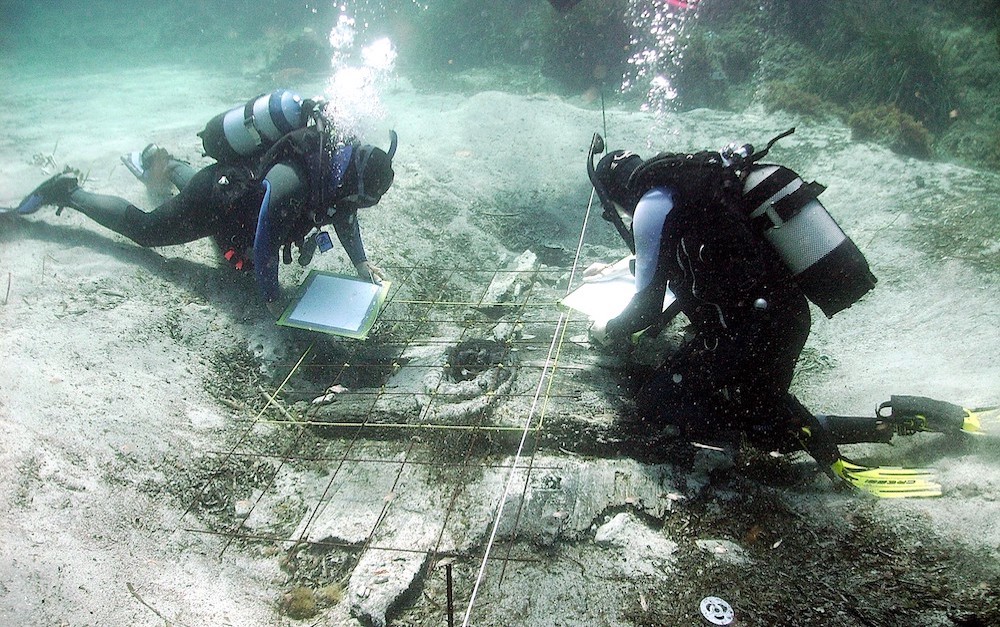
Underwater Archaeology in the Titicaca Lake
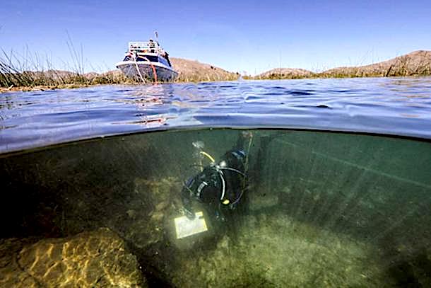
Lake Titicaca, located almost 4000 meters altitude in the Andes between Bolivia and Peru, remains of civilizations of more than 2000 years are hidden below the lake that a revolutionary plan of underwater archeology is trying to reveal.
Artificial Geopolymers in Tiahuanaco
Professor Joseph Davidovits
Research and filming works in Machu Picchu
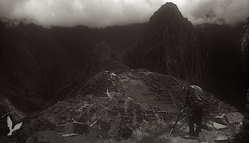
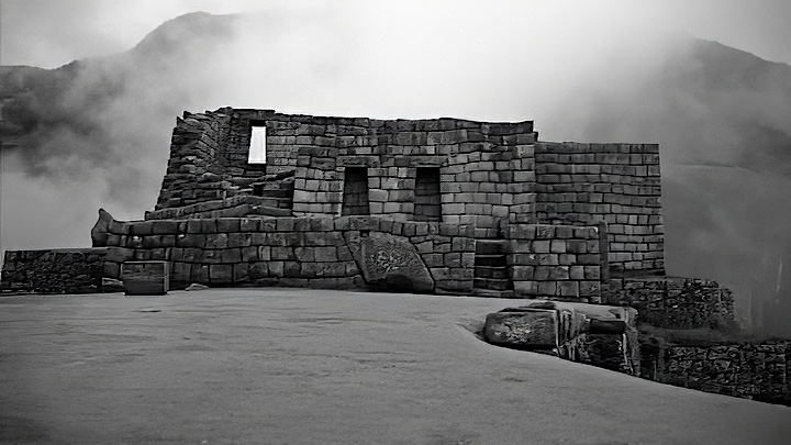
Archaeoastronomical work on the Intihuatana in Machu Picchu
Archaeoastronomical studies at the Intiwatana of Machu Picchu with Professor Benjamin Sánchez Fernández, Doctor mining engineer and professor at the University of Oviedo, Spain
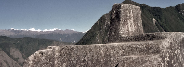
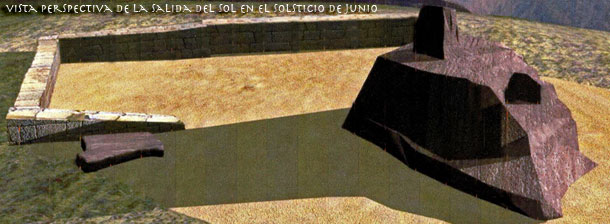
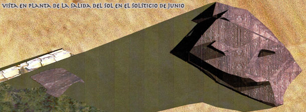
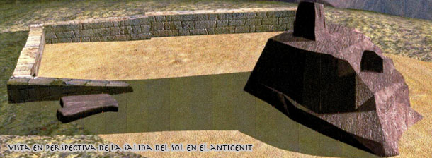
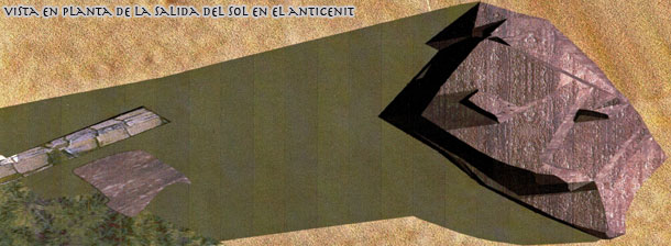
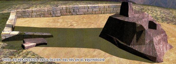
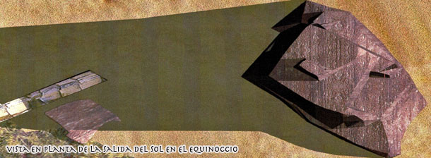
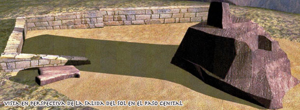
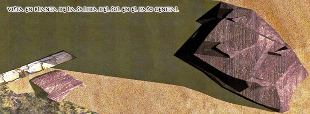
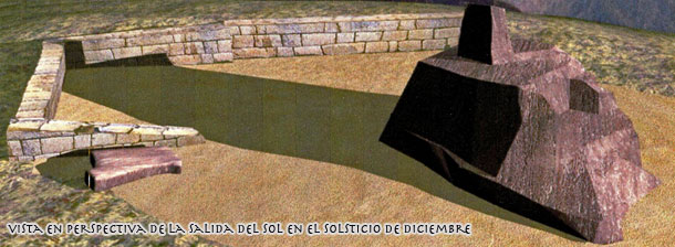
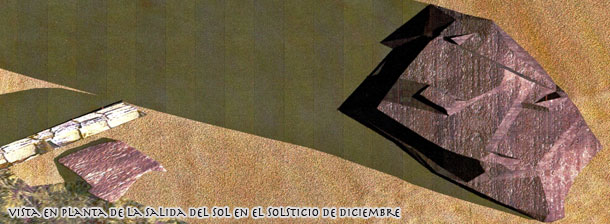
USE OF DIGITAL MODELS FOR THE ASTRONOMICAL INTERPRETATION OF INTIWATANA OF MACHU PICCHU
In this Works are used oriented digital models to make the astronomical interpetation of the intiwatana of Machu Picchu, which was carved into a granite rock with the course to know the different seasons of the solar year. For the digital model of the Intiwatana and its environment it was necessary to carry out a field work that was basically on positions with absolute coordinates using a GPS navigator a lifting speedometer accuracy with electronic total station and reflection and Miniprisms angular sun observations, using the total station to determine the direction of true north. The field work was done on 20 and 21 of June in 2000, obtaining the refered values of the WGS-84 system. Latitude: 13 ° 9 '47.3 "S, Longitude: 72 ° 32' 44.5" W; Ellipsoid height: 2500 m. Because of the mountains surrounding the citadel of Machu Picchu have a quite pronounced relief, in order to know its profile in areas where the sun rises and sets, horizontal and zenith angles of the highlights of the horizon were taken. These measurements are also oriented to true north with the data from the solar observation. To refer to true north coordinates of the measured points in an arbitrarily oriented system, it was necessary to solve the astronomical triangle formed by the peak position of the station point, the position of the center of the sun and the Earth's north pole. The data needed for this calculation were the geographical coordinates, latitude and longitude, obtained by GPS station point; the exact time it was noted in the sun, expressed in T.U. (Standard time + 5 hours); and the values of the declining, semidiameter apparent when the sun over Greenwich antimeridiano that were obtained from the yearbooks for instant astronomical observation. Once solved the astronomical triangle position 67.991 degrees azimuth to the origin of horizontal angles allowing the guide to true north taquimétrico survey conducted simply by making a turn (in topographical sense) of -67.991 degrees was obtained using as center turning the measurement station. For astronomical interpretation of Intiwatana among the many possibilities that exist, in this work it was chosen to study the shadows on the monolith at the moment of sunrise over mountains in singular dates, such as solstices June and December, the equinoxes and the passage of the sun through the zenith and antizenith the place of observation. he results obtained were: June solstice (June 21) Azimuth: 68.240 degrees; Zenith angle: 84.600 degrees December solstice (December 21) Azimuth: 124.408 degrees; Zenith angle: 89.088 degrees Equinoxes (March 20 and September 22) Azimuth: 96.779 degrees; Zenith angle: 86.444 degrees Cenit (February 14 and October 28) Azimuth: 112.149 degrees; Zenith angle: 86.763 degrees Antizenith (April 24 and August 17) Azimuth: 81.435 degrees; Zenith angle: 86.950 degrees From a several of photographs taken of the Intiwatana, from different perspectives and using a computer program, a photogrammetric digital model of the monolith mentioned was determined. The program used convergent part of frames of object to be reconstructed digitally, and requires that the frames completely sprinkle on the object, so that in each pair of adjacent frames there are at least three common and easily identifiable points. The program calculates the model according to the following process: * Determine the coordinates (x, y, z) of the points of making photographs. * Calculate the angles of orientation of the frame in space. * Find the coordinates (x, y, z) of each point on the object identified. Once we know the coordinates of each point on the object labeled it is possible to build a model using wired lines connecting the dots. This can be defined wireframe surfaces and textures give them obtained by the photographs.
INTERPRETATION OF RESULTS
If the representation is observed in plant obtained topographic digital model, you can see that the upper parallelepiped of Intiwatana is oriented such that the bisectors of the angles formed by the faces coincide quite precisely with the geographic directions north, south, east and west. Western edges of the upper platform Intiwatana, have an alignment parallel to the base of the upper parallelepiped, so that their bisector also indicates the west direction. The western part of the platform seems to be quite adequate for the observations of the shadows cast by the sun at dawn. At dawn on June solstice, step by antizenith, equinox, passing through the zenith and December solstice shows that the sun's shadow is projected on the upper platform of the Intiwatana, particularly on the edges to the west, proving as shadow moves over them, being the northwest ridge best suited to observe the zenith passage and December solstice. For other dates can be used either edges. In terms of precision that could determine these dates interest depends on the daily variation in the sun's declination in before and after the same day, is very small at the solstices, but the rest is variation more important, and given the distance from which the shade, which is about 0.6 meters, the daily movement thereof is approximately 5 mm is projected magnitude that is perfectly observable and that could determine without any uncertainty any of these dates, including the zenith passage, that would serve to know precisely the cycle of the solar year (tropical year) and as a consequence have a tool for measuring time.
Professor Benjamin Sánchez Fernández, University of Oviedo, Spain
Amazon Forest Expedition Alto Madre de Dios
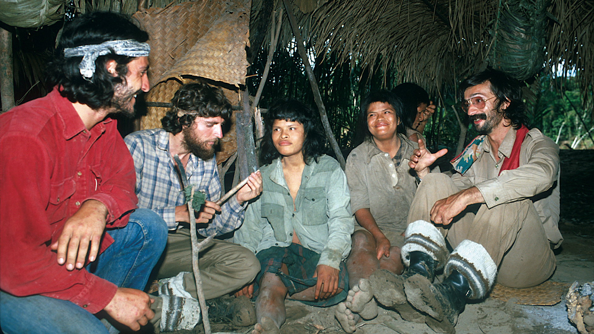
Contact with natives Piros and Machiguengas


In this expedition to the Peruvian Amazon Rainforest, the Pi Rambla Team collaborated with the anthropology department of the Complutense University (Madrid, Spain) on an ethnological research of the tribes Piros and Machiguengas of the zone of the Alto Madre de Dios.
These studies were complemented with ecological research in collaboration with the North American biologist Dra. Jane Stern of the department of zoology of the University of California (Davis) and professor of Biology in Berkeley (USA).
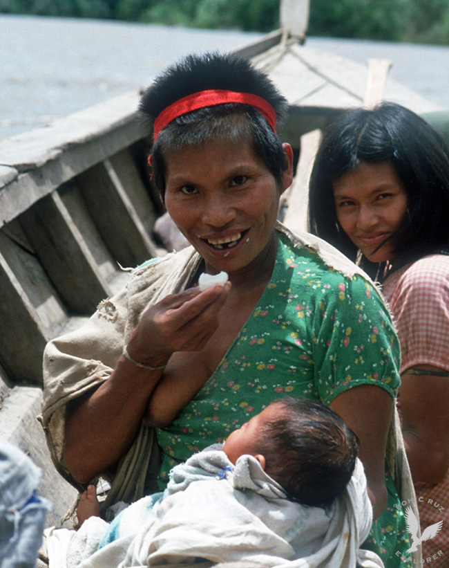
With a total of 8679 registered individuals, the Machiguengas constitute 3.62% of the registered indigenous population. This total does not include the isolated population whose volume cannot be determined. Nor does it include the kugapakori already sedentary and established relatively a few years ago in Montetoni and Malanquiato, in Alto Camisea, with a population of approximately 240 individuals. Population estimates considered a minimum of 7000 people (Wise and Ribeiro, 1978) to a maximum of 12000 people for this group (Varese, 1972; Uriarte, 1976).
In 1924, the missionary Navarro estimated its population at only 3000 or 4000 individuals. In the Machiguengas settlements there are an average of 271 people, although those established in the Manu area are smaller with an average of 100 people.
The masculinity index is 104.2, which is below the average registered for the entire census indigenous population. The distribution of the population according to age indicates a large group of children under 15 years of age (49.6%) and only 1.2% over 64 years of age, which characterizes a young and growing population. The crude death rate is 11.29.
Research & filming Aobamba Intiwatana
Archaeoastronomical Study
Like the rest of the sites occupied by the Incas in the Urubamba River, near Machu Picchu, in the Intiwatana area there are sidewalks, grounds and ceremonial sites with stone sculptures
The Urubamba river in its route to Machu Picchu bends that aligns with the area that is obtained the water for central facilities. In the 121 km of the railroad agricultural platforms and ceremonial complex are located. In the lower part of the slope occupied by the archaeological site, the farmers know the name of the hill as "El Calvario” has traced the development of the railway which forms a zig-zag to save excessive slope. Down of the railway are the extensive facilities of the Electricity Generation Company in Machu Picchu. The area described is situated on the left bank of the Urubamba River, which later receives waters of the stream Aobamba. The place was visited by travelers and members of the scientific expedition that led Hiram Bingham, who made the first scientific recognition site. The agricultural terraces were always used by the farmers settled in the area, who probably looted existing graves at the site, long before the arrival of that expedition. It is a very poorly documented testimony prehispanico which there are almost no references.
Description of the set
An unknown Intiwatana in the Urubamba
The site is enclosed by steep slopes that descend to the river. To the west side are the Llactapata and Puncuyoc hills to the north Cerro San Cristobal, on the right bank of the Urubamba River and the east side hill called Yucaypata. In that frame of topography it stands on the east side, in the upper part of the slope, a sort of rocky promontory known as Yanacaca. That lytic formation seen in the distance as the silhouette of the head of a flame and is located just in a place that is observed from the Intiwatana of Machu Picchu. It is likely that natural element triggered the creation of the ceremonial sector we describe, which has been chosen so as to have direct toward the back of Machupicchu visual. The site can be seen in the distance the pyramid promontory where the Intiwatana of Machu Picchu is located, showing a room with two windows and stepped platforms.
Alignment with the ceremonial center of Machu Picchu
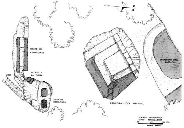
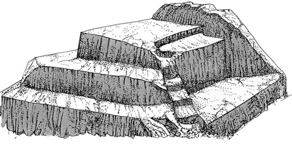
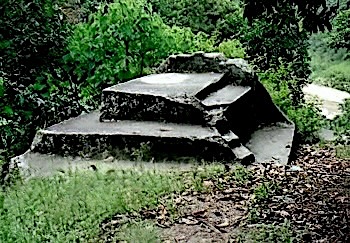
The Incas gave sculptural outcrops of rocks that were in the places they recognized a magical or religious forms. In this case the hard granite rock sculpted masterfully to express the complex symbolism of the Tawantinsuyo worldview. Attached to the slope of the hill it is located the source of ceremonial face to the North East, as well as the ceremonial seats and pyramid sculpture located a few meters away, forming a set of ritual use facing the rising sun. In the same orientation coincides with the location of pyramidal mound of Machu Picchu, visible in the distance. The source has been shaped like a block of granite rock flat and vertical, four meters long and one meter sixty to eighty centimeters high and just wide. It has been carved on a outcrop of rock by matching its middle channel, also carved in the stone, which allows access of water then leaves four suppliers cut into the face of the stone, as openings runs equidistant two feet each other. This lytic volume occupies the central part of sacred space and was the main shrine. Masterfully sculpture provides, thanks to the play of light and shadow that accentuate their geometric design, the vision of a phased sign of deep significance in Inca iconography.
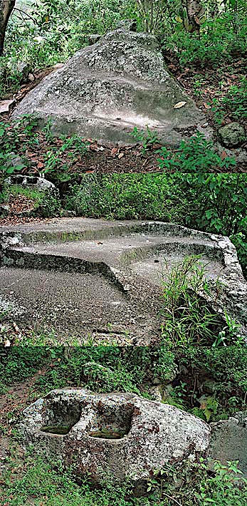
The stepped sign is linked to lightning, Illapa, which in turn is associated with water divinity. However, the face of the sculpture that receives sunlight in the morning is a truncated triangle geometric shape that could be related to the worship of Punchao, the divinity of the day. To the East side of the sculpture, it exists on a carved rock with curved staircases platform, which are descending into a ravine cut vertically. This concave size received the water that ran the ceremonial source and derived to fall like a veil on the vertical section of the creek. The use and function of this sculpture, and his real name in Inca times is unknown to us yet, because they have done work ethno-historical and archaeological research. Thanks to the quality of the stone material on which it has carved sculpture, his condition is good, although regrettable neglect of the site is devoid of a direct and convenient access.
Vicuña Project - Pampa Galeras Reserve
Works in the Reserve of Pampa Galeras with Dr. Felipe Benavides, president of the World Wildlife Fund of Peru (PRODENA)
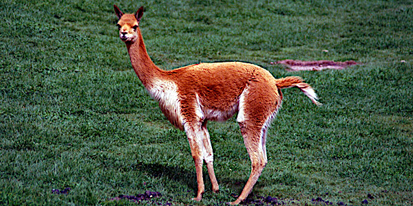
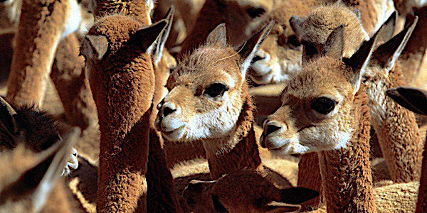
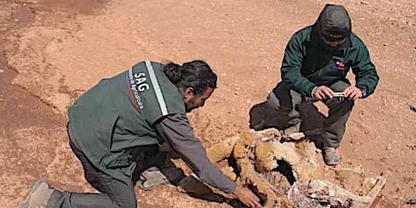
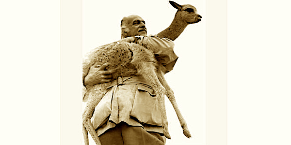

Anselm Pi Rambla & our Team collaborated in the Pampa Galeras Reserve with PRODENA (WWF-Peru) and Dr. Felipe Benavides in the preservation of Vicuñas and Guanacos of its extinction.
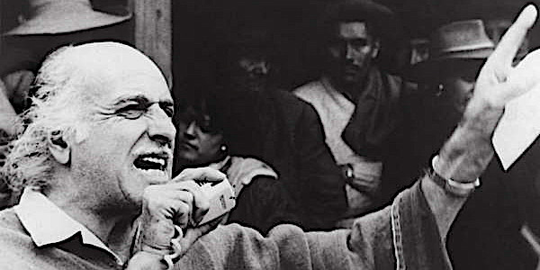
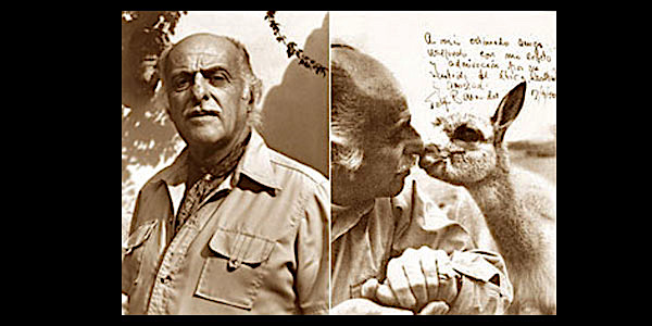
Felipe Benavides
40 years ago Felipe Benavides Barreda (1917-1991), a successful person in protecting natural heritage, became the first winner of the award “J. Paul Getty Conservation of Wildlife”. Thanks to his interventions could save the vicuna extinction by hunters.

Felipe Benavides, winner of the Paul Getty Award
Works in the Paracas Reserve
Problematical of El Niño affecting thousands of migratory and local birds
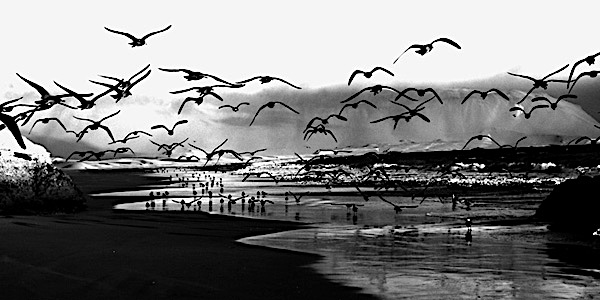


In climatology it is called El Niño, a cyclical climate erratically syndrome, which is a change in the patterns of movement of air masses causing therefore a delay in the kinetics of the "normal" currents, triggering warming of South American waters; that causes real Worldwide damage affecting South America, Indonesia and Australia. The name "El Niño" is due to fishermen from the port of Paita in north Peru that found that the waters of the Peruvian Current or Humboldt Current, which flows from south to north off the Peruvian coast, warmed at the time of Christmas holidays of fish or fleeing south, due to a warm current from the Gulf of Guayaquil (Ecuador). This phenomenon was given the name El Niño Current. The scientific name is El Niño Southern Oscillation (El Niño-Southern Oscillation, ENSO, for its acronym in English). It is a phenomenon with over eleven thousand years of climate history.

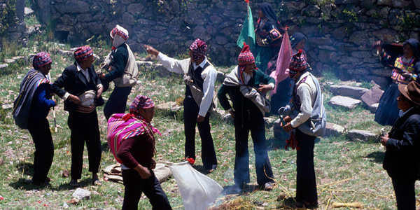
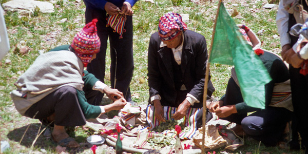
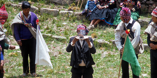
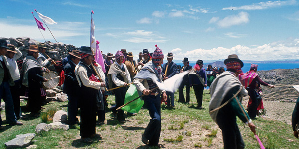
Ritual Pachamama (Amantani island, Titicaca)
Tribute to Mother Earth
Filming and studying the PACHAMAMA ritual made in one of the islands of Lake Titicaca. The ritual performed on this island is one of the most important in Peru. The central ritual of the Pachamama or Mother Earth is the Challa or payment (tribute). It is made by the first day of August, throughout the month. The ceremonies are run by elderly or greater moral authority within each community people. In the case of the Aymara people this person is called "Yatiri". At the end of the ceremony Yatiri interprets the events of the year, especially regarding the results of the crops.